Nosdivad Blog

Drone Surveys

The use of drones is becoming more prolific in the commercial space and has a myriad of applications, especially within the field of site development and maintenance. Here are just a few:
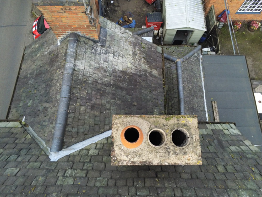
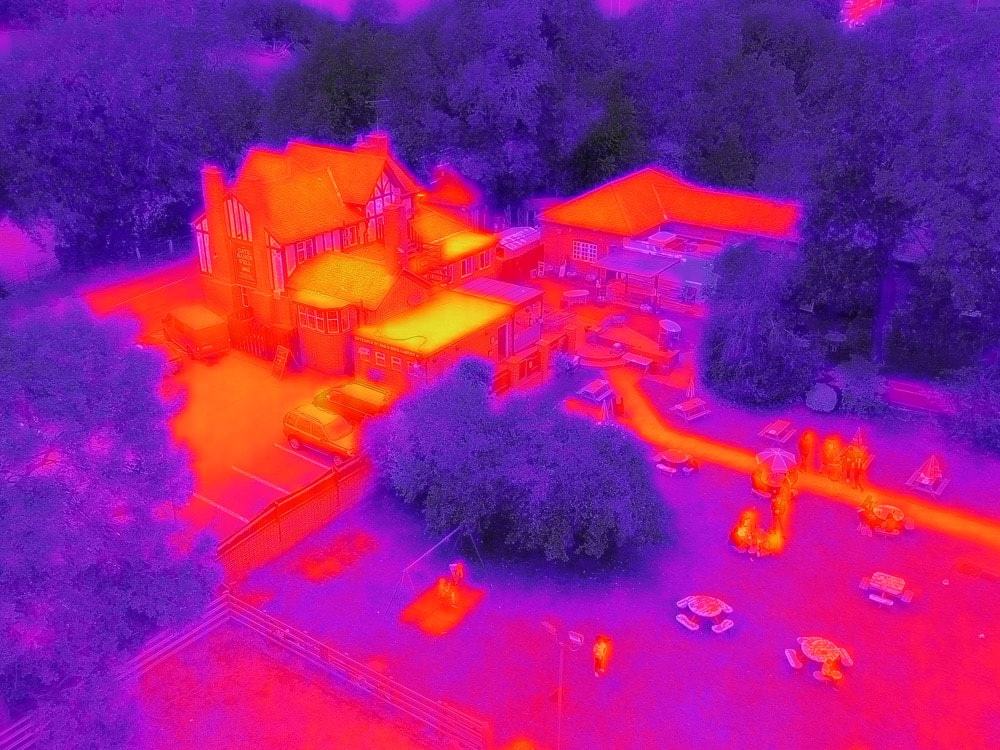
  • Structural surveys and inspections
  • Site layout design
  • Photography
  • Problem solving and fault finding

Welcome to the future

The advent of high resolution gimble mounted cameras (some with thermal imaging capability) on very stable multi-rotor GPS stabilised drones has become a total revolution in the way we do site surveys. It's literally the most cost-effective surveying solution if you compare it to the following traditional methods of surveying.

Scaffolding

Erecting scaffolding is the least cost-effective solution to a site survey as well as the most disruptive.

First you need to put together a risk assessment. The permit process can take up to a week or more, then there is the design of the scaffolding, the access required for a lorry to take the scaffolding materials on site, all of the labour to pay for as well as the time to erect and dismantle. All in all with a small survey you could take up to a week and have a typical cost starting from around £1500.00 depending on the size of survey required.
Assessing the damage to a chimney stack during a drone survey of the roof of an old farm house

Scissor lift or cherry picker

This solution can be a little more cost effective however you still need access for the lorry to carry the machinery, there is also potential for not having ground space for the device to fit in. You still need to do a risk assessment and would have to wait for the delivery and collection. Scissor lifts and cherry pickers are also rather costly to hire and require an operator and it’s a problem if you don’t have anywhere to park them for collection. So even though the time taken to survey the site is less it’s still potentially several days to complete.

Both options above are very costly, can be delayed either during, before or after depending on the weather and both of the above alternatives will only get you up on the roof. You still need roof crawler boards to get around when you’re up there.
Using the infra-red drone camera to spot heat sources and potential insulation issues

Drone surveys

A drone survey can be performed almost at the drop of a hat. Permission to film on site with a drone is required but that is simple to get. Then checking the weather forecast for a mild day (rain or high wind need to be avoided but gentle non-gusty winds are fine as the drone is stabilised) and you're all booked in.

Using a drone not only takes away the huge planning needs and construction costs of scaffolding and the hire costs of the cherry picker. It also takes way less time to do the survey and the quality is perfect for this type of scenario.

It's also good to mention at this point that we are fully PfCO (C.A.A. Permission for Commercial Operations) compliant.

Whichever infrastructure based type of physical surveying process is chosen (scaffolding, scissor lift or drone), the physical survey is only the first part of the survey itself. There is also the survey report and any potential drawings that may be required to be created. These documents also add a certain figure to the cost and to the time taken to complete the survey.
David with the drone ready for a hand launch to start a survey of the farm house
The first place to call for renewable energy technologies
© 2021  Aztec Internet
Top crossmenu